Connected Cities
As featured in Fleet Equipment magazine – August, 2026
Municipalities are turning existing fleets into technology platforms.
Sensors bolted to intersections. Broadband runs to city buildings. Traffic systems tied into a central control room. For most municipalities, “smart city” means a significant infrastructure investment. But while valuable, those stationary technologies share a common limitation—they only see a specific point where they are installed.
Today, however, that is changing. Looking for that same kind of insight on a broader scale, cities are turning to the trucks that travel their streets every day. Refuse trucks, street sweepers, and other public works vehicles cover nearly every residential street on a fixed schedule, often multiple times a week. Now, cities are starting to see that routine differently, viewing opportunities to connect fleet assets with smart-city technology.
The strategy is simple: the vehicles are already doing the work. What else can that same route produce?
“Cities don’t need to buy new vehicles or build inspection programs to get this kind of visibility,” said Dave Young, chief commercial officer of Environmental Solutions. “The trucks are already on the street. The question is whether they’re set up to capture what they’re passing every single day.”
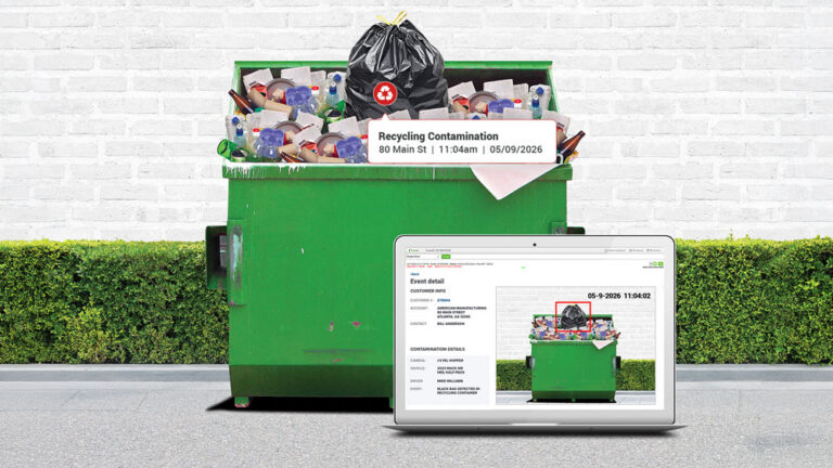
The Connected City solution from 3rd Eye, part of Environmental Solutions, and a segment of Terex Corporation, provides camera and telematics systems for refuse collection and other types of fleets, putting that logic into practice. Cameras and computer vision get added to vehicles already running routes, and as the truck moves through its schedule, the system identifies visible conditions in the public right-of-way and organizes them by location so municipal staff can review and act on them.
Timing Matters
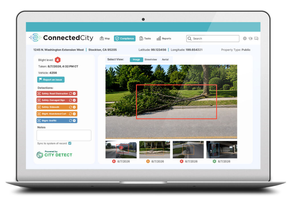
“Nothing about the driver’s job or the route changes,” Young said. “The bigger shift is not really about cameras. It’s about timing. Municipalities have relied on periodic condition surveys, non-emergency citizen notification channels such as 311, resident complaints, or a crew member happening to notice a problem while working on something else entirely. Each of those depends on a person reporting a condition after it has already become one.
“Real-time data closes that gap,” Young continued. “In several California communities, for example, crews are using route-based detection to flag graffiti, illegal dump sites, and abandoned shopping carts and vehicles almost as soon as they appear.
“In wildfire-prone regions, that same passive scanning is being used to spot tall, dead grass and abandoned structures, the kind of conditions that turn a manageable fire risk into a serious one if nobody catches them early,” Young added.
The scale shows up most clearly in emergencies. Route-based condition monitoring can cut the staff time required for a citywide survey by up to 97% compared to sending people out to inspect manually, Young related.
“When the City of Greenville, South Carolina needed to assess storm damage after Hurricane Helene, four equipped vehicles covered 300 miles in three days and mapped nearly 3,000 debris piles, information that would have taken a conventional survey crew far longer to compile,” Young reported.
Becoming a Spec Requirement
While fleet specifications focus almost entirely on the vehicle, Young pointed out, cameras and telematics have become part of that conversation over the past several years, first for safety, then for service verification.
Community condition data looks like the next line item, Young noted. The questions to ask go beyond whether a truck can carry a camera, and include:
- Can the system run on vehicles already in the fleet, or does it require new equipment?
- How does it integrate with the systems departments already use to track, assign, and close out work?
- Who verifies a detection before it becomes a work order, and how long is the footage retained once it’s collected?
“Those items are already starting to show up as specification language in RFPs, and fleets that can answer them clearly are the ones winning the work,” Young stated. “For private fleets under contract with municipalities, that shift is becoming an opportunity.
“For example, a refuse hauler whose trucks already cover every residential street can offer a city something far beyond just collection service,” Young continued. “In this case they can be a continuous, low-cost source of community condition data the city would otherwise have to build a separate program to collect. In markets where multiple providers offer comparable collection equipment and pricing, that additional capability can be the difference in a competitive bid.”
Consolidated Value
For cities, according to Young, the value lies in consolidation. Service verification, fleet maintenance, fleet and asset tracking, pavement assessments, code compliance reviews, and storm damage evaluations have traditionally required separate software platforms and vendor contracts.
“By leveraging technology already deployed on municipal or hauler fleet vehicles, cities can replace multiple systems with a single solution, reducing software costs, simplifying vendor management, and providing a unified view of operations, assets, and service performance,” Young said. “It’s turning into a capability cities expect to see, not something a contractor brings up as an upsell.”
Young also pointed out that any conversation about cameras on public vehicles today has to start with an obvious concern. “Nobody wants a refuse truck being used as a surveillance tool,” he said. “Our approach is built around identifying conditions, not people. Faces and license plates get blurred automatically and imagery comes only from the public right-of-way.
“This kind of discipline matters as much as the technology behind it,” Young added. “A system that’s clear about what it does and doesn’t do, is the kind of system that survives a city council meeting and a public records request without controversy.”
Extending the Idea
With growing potential and uses for on-board connected systems, 3rd Eye, in partnership with City Detect, has planned additions to its technology that include front-facing road assessment built to identify potholes, pavement wear and roadway cracking.
“We’re extending the same passive, route-based approach to infrastructure that public works crews currently have to inspect by hand,” Young related. “But faster reporting is only part of the payoff. Catching pavement problems while repairs are still less expensive than a full repaving job is exactly the kind of preventive spending that stretches a public works budget further.
“Refuse fleets were never just collection vehicles,” Young added. “They were always a source of information nobody had built the tools to capture, cruising past the same curbs and driveways day after day without anyone thinking to ask what else that route could tell them. That’s no longer the case, and the municipal fleets and the cities they serve who recognize it early are going to have a real edge.”